


|
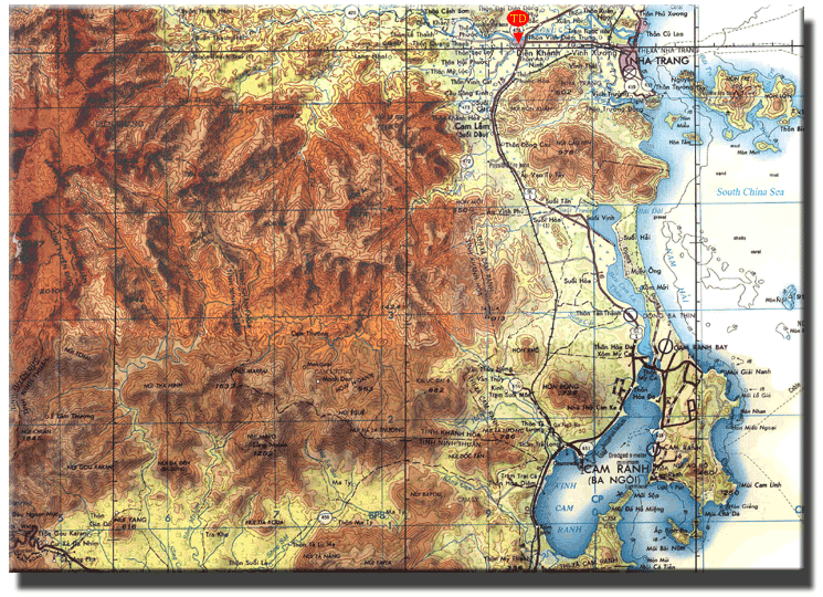
It may be evident that this is simply a larger version of the map on the
Map Room cover page. However, this map shows A-502's strategic location with regard to
its mission of protecting Nha Trang City and its supply routes. Camp Trung Dung, A-502's
main base, is marked in red near the top of the page. The camp was located at the
intersection of the east -west and north-south valleys so that it could detect and disrupt
enemy infiltrators approaching from the northwest, west, southwest and south. Other
units were responsible for the area north of the Song Cai River, which was the northern border
of A-502's AO. This map also shows Cam Ranh Bay along with the road and train tracks running north through the valley to Nha Trang. One of A-502's major responsibilities was proctecting these vital supply lines. The AO East map shows this area in greater detail. |
| |
Special Forces - The Silent Professionals |
United States Army Special Forces
Detachment A-502.